Roing trip was a kind of surprise for me. For most of the people living in Guwahati, the first encounter with the state of Arunachal Pradesh normally occur at the check-posts of Bhalukpong or Naharlagun, the nearest towns in this area. But in my case, the destiny took me all across the state of Assam, crossing from its eastern corner to the western corner to get the first sight of Arunachal Pradesh. It happened at the check-post of Jairampur, while moving on the legendary Stilwell Road towards India-Myanmar Border. I entered in Arunachal Pradesh from Jairampur check-post and continued my journey on the Stilwell Road towards Nampong.
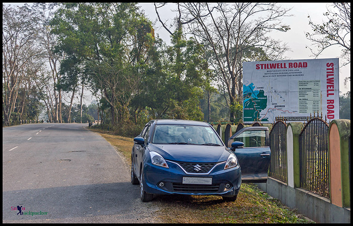
Journey On The Stilwell Road
That journey of 21 kms on one of the most famous road of British India left me completely puzzled. Not at a single place, Arunachal Pradesh looked like the place that I read and understood through the books till then. Arunachal Pradesh, that I knew, was the land of raging rivers, high mountains and dense forests. The forests, mountains and rivers; all are there on the way to Nampong, but they are not of that scale as I thought in my mind. A trip to the interior of nearby Namdapha National Park might have been a different perspective.
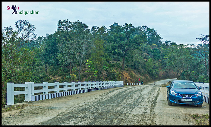
But, it was only the beginning. I just touched Arunachal Pradesh from the flat terrain of Assam while exploring the Stilwell Road. The entire area around the Stilwell Road has a significant place in the history of World War II. However, most of the stories of the war and the China-Burma-India (CBI) theater is slowly vanishing from the memories of the new generation.
Read more about Stilwell Road: Legacy of The Stilwell Road
After making and breaking with few important milestones of World War II history, I drove out from the Stilwell Road and landed in another corner of Assam to enter in Arunachal Pradesh again. This time, it was another check-post at Shantipur.
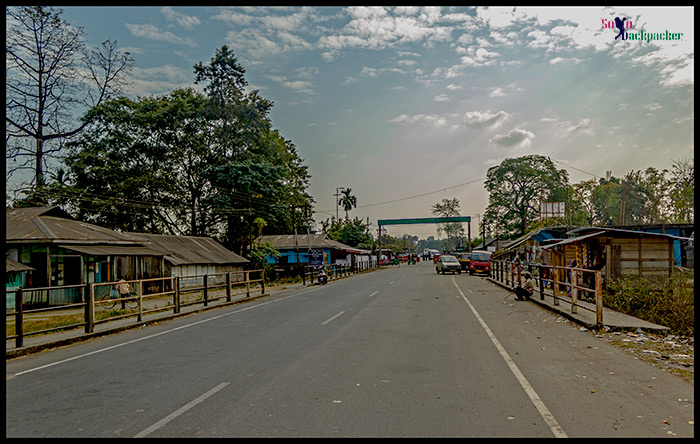
Crossing Dhola Sadiya and Entering Arunachal Pradesh from Shantipur Checkpost
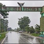
Before Shantipur check-post, Chapakhowa is the last town of Assam after crossing the famous Bhupen Hazarika Setu (Popularly known as Dhola-Sadiya bridge). From the beginning, this town acts as the gateway to the eastern boundary of Assam along with Sadiya. A little ahead from Chapakhowa is a check-post on the border of Assam-Arunachal Pradesh. It is not possible to cross the check-post at Shantipur without having a valid Inner Line Permit (ILP) issued by the Government of Arunachal Pradesh.
Read here for Inner Line Permit: How to get Inner Line Permit (ILP) for Arunachal Pradesh
Since, my initial plan was to roam around the area of Tezu and Roing, I already had a copy of the Inner Line Permit. If someone arrives here without a valid ILP, the provisions are there to issue an instant ILP at the check-post itself after the necessary verification.
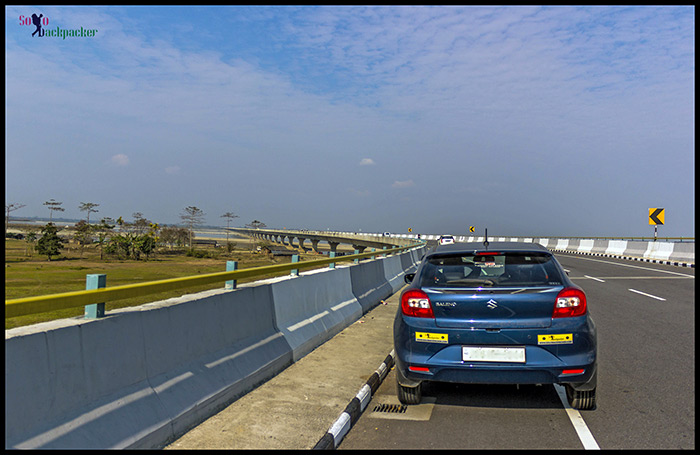
While Stilwell Road is an important milestone in the history , other places like Digboi, Doomdooma, Dhola, Sadiya etc of Tinsukia district in Assam also has an important role in the industrial development of this part of the country.
Read more about Digboi: Trip to the Oil Town of Digboi
Soon after crossing Tinsukia district at Shantipur check-post, the history begins to blur and the geography slowly changes into the land of high mountains, mighty rivers and dark dense forests where a constant struggle between the nature and the human takes place at each step. This different geographical area is known as the land of rising sun, a precious jewel in the crown of India, that has immense potential of tourism with mesmerizing natural beauties all around. This is actual Arunachal Pradesh, the North East Frontier State of India, that I know from the beginning.
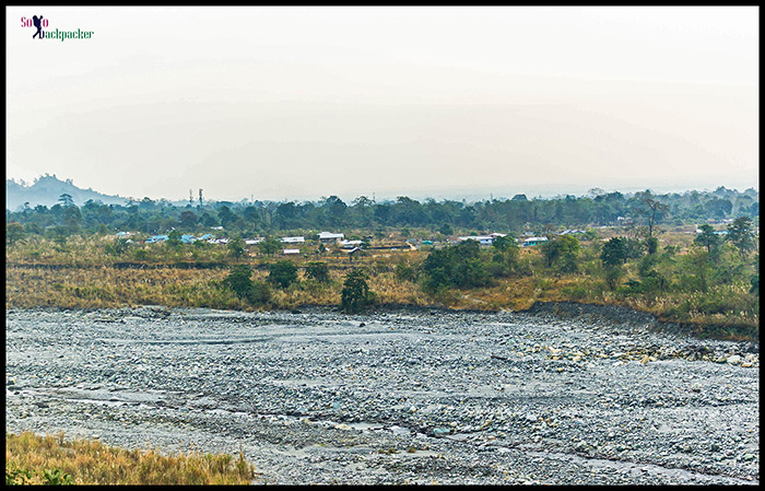
Roing Town in Arunachal Pradesh
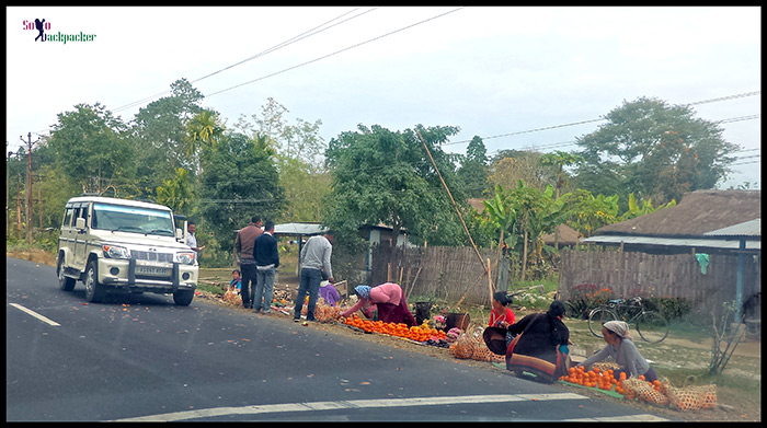
As I moved ahead of Shantipur check-post towards Roing town, the landscape on the both sides of the road is changed. Instead of Assam’s tea gardens and betel-nut tress, there are green forests on both sides of the road. On a straight and well-maintained road to Roing, I could see the mountains peeping out at the horizon. At many places, the local women were selling oranges on the either side of the road. The nearby Dambuk town is actually a major center for orange production.
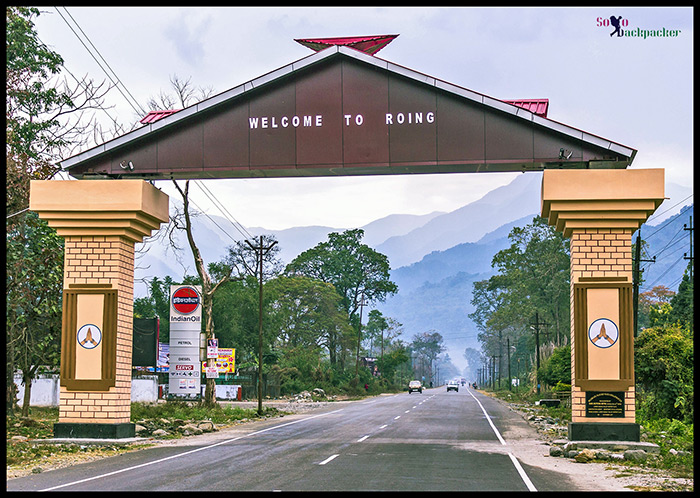
Roing is a entry point for the other far flung areas like Hunli, Anini in Arunachal Pradesh upto the border of China. Roing is quite a big town, but after crossing the main market it looks nearly empty. There is some shops and restaurants on both sides of the road.
Finding Accommodation in Roing
Like everywhere else during the trip, I tried to book a guest house of PWD or Forest Department, but like everywhere, it was a disappointment at Roing also. Only Arunachal Tourism knows the reason behind advising the tourists to use these government rest houses while travelling in Arunachal Pradesh. I never succeed to book a single guesthouse for the night stay. It actually requires a lot of pain and coordination to book a night stay at one of these Inspection Bungalows (IBs) or Rest Houses (FRHs). However, I have yet to check the possibility of booking these rest houses at remote places in Arunachal Pradesh.
Anyway, I did a quick search in the town and found a good hotel for the night stay. There was still a lot of time remaining in the daylight, so after a little rest, I decided to explore around the town.
On The Road to Mayodiya Pass
Mayodia Pass is about 50 km away from Roing. It is considered as a suitable place to experience the snowfall during the winter. Since it was only 50 kms approx from Roing, I could have reached there in the later part of the day also but unfortunately I was in the state of Arunachal Pradesh. The condition of the roads in Arunachal Pradesh changes fortnightly.
I heard that the road is in very bad condition after crossing the Roing town, upto Mayodia Pass. There was no chance to reach Mayodia Pass and return by evening in the remaining daytime. I wanted to move a bit ahead on that road. I thought that if road would be very bad, I would just return from that point.
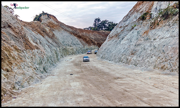
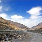
Deopani Picnic Spot, located on the outskirts of the town, is the most famous attraction in Roing. Just after crossing the Deopani River, I found the first trace of badly-shaped road towards Mayodia Pass. Rugged and bumpy roads, with deep gorges on the one side and the high mountains on the other side indicated that it was going to be a rough and tough drive.
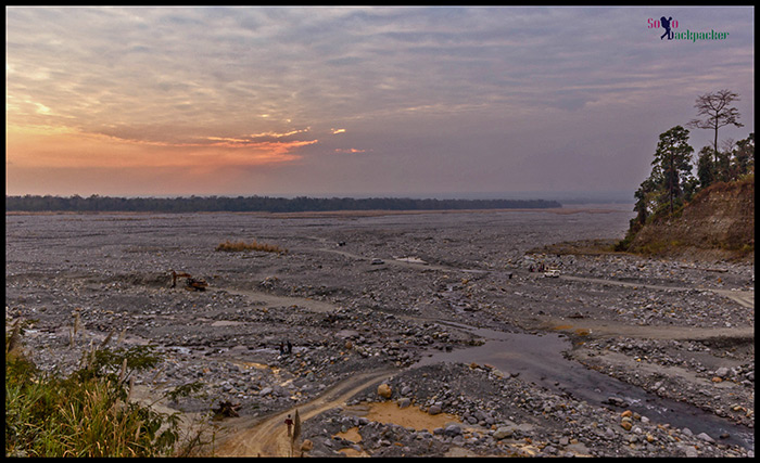
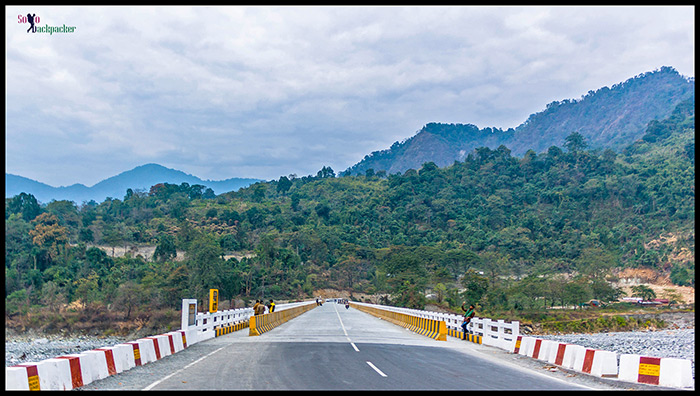
After about 5 kms of drive, I met another river. The road condition was so bad, that the driving on the road felt like a punishment rather than the fun. I stopped near the second river. It was a short drive in the outskirts of Roing but the world-renowned beauty of Arunachal Pradesh was there in that short distance only. The landslide prone mountains and dense forests was there in front of me, but the raging rivers had been dried significantly. However, considering their both banks and the empty land in between, I was sure that when they roar during the summer, it becomes very difficult to handle their flow without causing any damage.
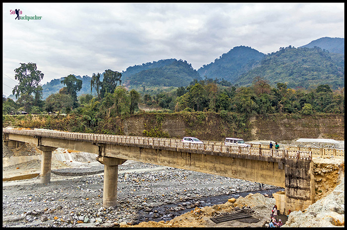
After spending some time near the river, I turned back towards Roing. There was so much fear in the mind that I couldn’t get the courage to drive on the steep narrow road going towards Sally Lake. Without visiting Sally Lake, I drove further to Deopani Picnic Spot.
Deopani Picnic Spot in Roing
The picnic spot of Deopani was buzzing with the tourists. It is apparent that Dhola-Sadiya Bridge is a boon for the people living in the vicinity , but it is actually Roing that would be in very advantageous position after the opening of that bridge. As long as the Bogibeel Bridge on the Brahmaputra river near Dibrugarh is not going to be operational for the public transport, Roing is all set to be an ultimate hill station for majority of the people living in Upper Assam.
Note: In December, 2018, Bogibeel Bridge on the Brahmaputra River became operational. Few months later, a bridge on Dibang River on the road from Roing to Dambuk became operational. Dambuk is famous for The Orange Festival and now connected with Roing throughout the year after opening of the bridge. Roing is still a hotspot destination for the tourists.
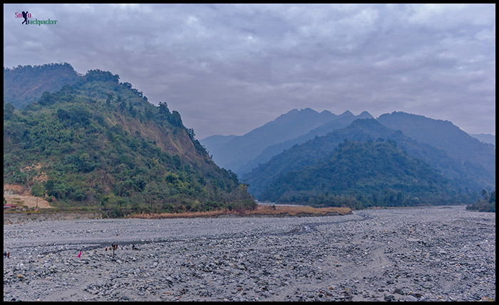
The tourist influx in Roing is rapidly increasing. Most people come from nearby eastern parts of Assam to enjoy the picnic on the banks of the Deopani river and return on the same day. Beyond Deopani river, there are series of the mountains towering high one after the another. If the people are interested in more adventurous journey, they continue their journey further towards Mayodia Pass, Hunli and Anini.
After spending some time at Deopani Picnic Spot, I returned to the hotel and it became completely dark by that time. I wanted to go to main market for the dinner. After walking for half an kilometer, I wasn’t feeling good to continue further in that chilly winter night with black pitched darkness all around. Finally, I arranged some food from a nearby local shop and returned to the hotel.
Following morning, as per the initial plan, I was supposed to roam around Roing in the morning and then drive to Tezu to reach there as soon as possible. After starting my onward journey from Roing, the events occurred in such a way that I drove on a road or almost no road in the land of raging rivers. On that day, I couldn’t reach Teju and Parshuram Kund , but instead, I kept moving through the villages of Bomijir, Dambuk and Seluk to experience one of the most adventurous journey of my lifetime. At the end of the day, I was there at Dhemaji on the way to Majuli, the largest river island of the world. But Majuli was still far and it was going to be a long journey, the stories from that journey would continue in the next post.


Awesome… M coming there fr a long ride
Hi, Enjoyed reading your blog. Your guidance on ILP was quite useful. I agree with you – our preferences are ultimate!
May I take your help when I plan a trip to Arunachal in 2019?
Hi, sure. You can ask any information.
How do you find time to travel? Do you regret spending money on travelling?
No Dear. There is no regrets. Travel is the only luxury that I can afford in my life and I am absolutely enjoying this. It is just about our preferences. 🙂